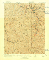
1927 Map of Iaeger
USGS Topo · Published 1951About this map
Tug Fork and Dry Fork define the movement of goods and people through this mountain landscape at the border of West Virginia and Virginia. The Norfolk and Western RR winds along the riverbanks, connecting industrial points like Krollitz, Litwar, and the hub at Iaeger. This era shows a high density of rural institutions serving the coal and timber regions, including the Bee Run Church and more than twenty neighborhood schoolhouses such as McKinley School, Trap Fork School, and High Knob School.
Find a feature on this map
160 named features on this map. Tap any name to fly to it.
Don’t see what you’re looking for? This feature index may not catch every label — zoom into the map to look around manually.
Map Details
Editions of this 1927 Iaeger Map
3 editions found
Other maps of this area

1886 · Grundy
USGS Topo · 1:125,000

1887 · Warfield
USGS Topo · 1:125,000

1890 · Grundy
USGS Topo · 1:125,000

1891 · Tazewell
USGS Topo · 1:125,000

1891 · Oceana
USGS Topo · 1:125,000

1891 · Warfield
USGS Topo · 1:125,000

1892 · Grundy
USGS Topo · 1:125,000

1893 · Oceana
USGS Topo · 1:125,000

1895 · Tazewell
USGS Topo · 1:125,000

1897 · Tazewell
USGS Topo · 1:125,000