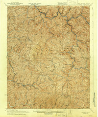
1927 Map of Iaeger
USGS Topo · Published 1942About this map
Tug Fork flows through a landscape defined by sharp elevation changes and the industrial corridor of the Norfolk and Western RR. Surveyed in the early twentieth century, this map documents a mountain society organized around isolated creek hollows and the coal-hauling rail line. At the hub of this network sits Iaeger, while numerous small post offices like Avondale PO Ritter, Gluck PO, and Matney Stacy PO signify a once-vibrant system of rural mail distribution.
Find a feature on this map
107 named features on this map. Tap any name to fly to it.
Don’t see what you’re looking for? This feature index may not catch every label — zoom into the map to look around manually.
Map Details
Editions of this 1927 Iaeger Map
3 editions found
Other maps of this area

1886 · Grundy
USGS Topo · 1:125,000

1887 · Warfield
USGS Topo · 1:125,000

1890 · Grundy
USGS Topo · 1:125,000

1891 · Tazewell
USGS Topo · 1:125,000

1891 · Oceana
USGS Topo · 1:125,000

1891 · Warfield
USGS Topo · 1:125,000

1892 · Grundy
USGS Topo · 1:125,000

1893 · Oceana
USGS Topo · 1:125,000

1895 · Tazewell
USGS Topo · 1:125,000

1897 · Tazewell
USGS Topo · 1:125,000