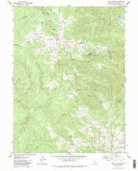
1979 Map of Iaqua Buttes
USGS Topo · Published 1979About this map
Kneeland Airport serves as a localized hub in this high-elevation terrain of Humboldt County, situated atop the ridges between the Mad River and the complex drainage systems of the Elk River. The landscape is defined by its significant relief, featuring the Iaqua Buttes and prominent divides like Barry Ridge and Ashfield Ridge. This 1970s survey illustrates a specialized infrastructure suited for the elevation, including a Radio Tower (KIEM TV) and a dedicated Radio Facility. The network of transit is primarily composed of ridge-top routes such as Kneeland Road and Tim Mullen Road, which connect isolated features like Lone Star June and various corrals. Numerous springs and named gulches like Painter Gulch feed into the Lawrence Creek and Freshwater Creek systems, highlighting a topography shaped by steep timberland and narrow valleys characteristic of the northern coastal ranges.
Find a feature on this map
42 named features on this map. Tap any name to fly to it.
Don’t see what you’re looking for? This feature index may not catch every label — zoom into the map to look around manually.
Map Details
Editions of this 1979 Iaqua Buttes Map
2 editions found
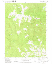
Other maps of this area

1922 · Eureka
USGS Topo · 1:62,500

1922 · Korbel
USGS Topo · 1:62,500

1922 · Kneeland
USGS Topo · 1:62,500

1933 · Eureka
USGS Topo · 1:48,000

1942 · Eureka
USGS Topo · 1:62,500

1944 · Fortuna
USGS Topo · 1:62,500

1945 · Blue Lake
USGS Topo · 1:62,500

1949 · Eureka
USGS Topo · 1:250,000

1950 · Iaqua Buttes
USGS Topo · 1:62,500

1951 · Eureka
USGS Topo · 1:62,500