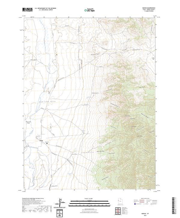
2023 Map of Ibapah
USGS Topo · Published 2023About this map
Deep Creek Valley serves as the central corridor for this West Desert landscape, where the settlement of Ibapah anchors a region defined by high mountain passes and historic transit routes. The geography is shaped by the towering Deep Creek Range to the east, peaking at Ibapah Peak, and the Cherry Creek Range to the west. Evidence of early transcontinental travel is preserved in labels for the Old Lincoln Hwy and Pony Express Canyon, marking the evolution of westward movement through this arid basin. Water sources are critical here, with several named springs such as Greasewood Spring, Secret Spring, and Gladman Spring providing vital points in the desert. Near the village, the Ibapah Cem and the Goshute Airport provide specific points of interest for genealogists and researchers looking at this borderland between the Utah and Nevada high desert.
Find a feature on this map
53 named features on this map. Tap any name to fly to it.
Don’t see what you’re looking for? This feature index may not catch every label — zoom into the map to look around manually.
Map Details
Editions of this 2023 Ibapah Map
This is the sole edition of this map. No revisions or reprints were ever made.
Other maps of this area

1908 · Fish Springs
USGS Topo · 1:250,000

1910 · Fish Springs
USGS Topo · 1:250,000

1925 · Gold Hill
USGS Topo · 1:62,500

1928 · Gold Hill
USGS Topo · 1:62,500

1953 · Tooele
USGS Topo · 1:250,000

1953 · Delta
USGS Topo · 1:250,000

1955 · Tooele
USGS Topo · 1:250,000

1955 · Elko
USGS Topo · 1:250,000

1956 · Ely
USGS Topo · 1:250,000

1958 · Elko
USGS Topo · 1:250,000