1984 Map of Ibex Pass
USGS Topo · Published 1985About this map
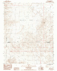
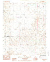
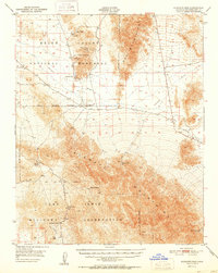
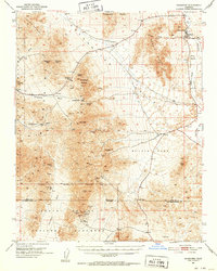
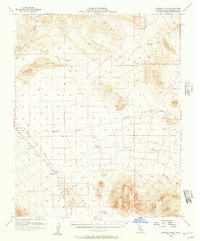
Death Valley National Monument dominates the western portion of this mid-1980s landscape, where the Mojave Desert meets the southern edge of Inyo County. The terrain is defined by dramatic elevation changes between the Ibex Hills and the Sperry Hills, centered on the crucial transit point of Ibex Pass. This survey documents a rugged corridor where the Old Spanish Trail Highway cuts across the northern desert floor, tracing a path toward the Amargosa River. Evidence of historical land use is sparse but significant, including a Mine located near the eastern ridges and the presence of a Spring and Spring Road at the base of the Saddle Peak Hills, indicating the critical importance of water sources in this arid region. The boundary between Inyo and San Bernardino counties bisects the map, marking a transition in regional administration amidst the desolate peaks of Tecopa Peak and Mc Lain Park.
Find a feature on this map
15 named features on this map. Tap any name to fly to it.
Don’t see what you’re looking for? This feature index may not catch every label — zoom into the map to look around manually.
Map Details
Editions of this 1984 Ibex Pass Map
2 editions found
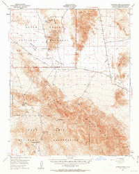
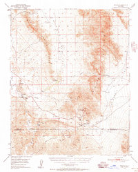
Other maps of this area

1933 · Avawatz Mountains
USGS Topo · 1:250,000

1947 · Trona
USGS Topo · 1:250,000

1948 · Trona
USGS Topo · 1:250,000
1948 · Avawatz Pass
USGS Topo · 1:62,500
1950 · Tecopa
USGS Topo · 1:62,500
1951 · Avawatz Pass
USGS Topo · 1:62,500

1951 · Tecopa
USGS Topo · 1:62,500
1951 · Shoshone
USGS Topo · 1:62,500

1953 · Trona
USGS Topo · 1:250,000
1956 · Silurian Hills
USGS Topo · 1:62,500