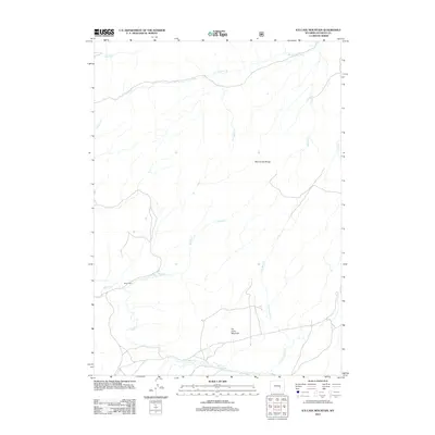
2012 Map of Ice Cave Mountain
USGS Topo · Published 2012About this map
Ice Cave Mountain and the Deer Creek Range dominate this high-elevation landscape in Wyoming's Natrona County, where a complex network of drainage basins defines the terrain. The presence of Miles Cabin near the banks of Spruce Creek suggests the enduring history of high-country ranching or land management in this area. This topographic study reveals a rugged hydrologic system where northern-flowing waters like W Fork Deer Creek and Spring Creek contrast with the southern drainage of Bates Creek and its tributary, E Fork Bates Creek. The convergence of smaller streams such as Andys Creek, King Creek, and Kerfoot Creek underscores the map's focus on the vital water resources that sustain the high plains and mountainous surroundings.
Find a feature on this map
12 named features on this map. Tap any name to fly to it.
Don’t see what you’re looking for? This feature index may not catch every label — zoom into the map to look around manually.
Map Details
Editions of this 2012 Ice Cave Mountain Map
This is the sole edition of this map. No revisions or reprints were ever made.
Other maps of this area

1955 · Casper
USGS Topo · 1:250,000

1958 · Casper
USGS Topo · 1:250,000

1959 · Squaw Spring
USGS Topo · 1:24,000

1959 · Bates Creek Reservoir
USGS Topo · 1:24,000

1960 · Crimson Dawn
USGS Topo · 1:24,000

1960 · Sheep Creek
USGS Topo · 1:24,000

1960 · Mud Springs
USGS Topo · 1:24,000

1960 · Ice Cave Mountain
USGS Topo · 1:24,000

1960 · Banner Mtn
USGS Topo · 1:24,000
1960 · Otter Creek
USGS Topo · 1:24,000