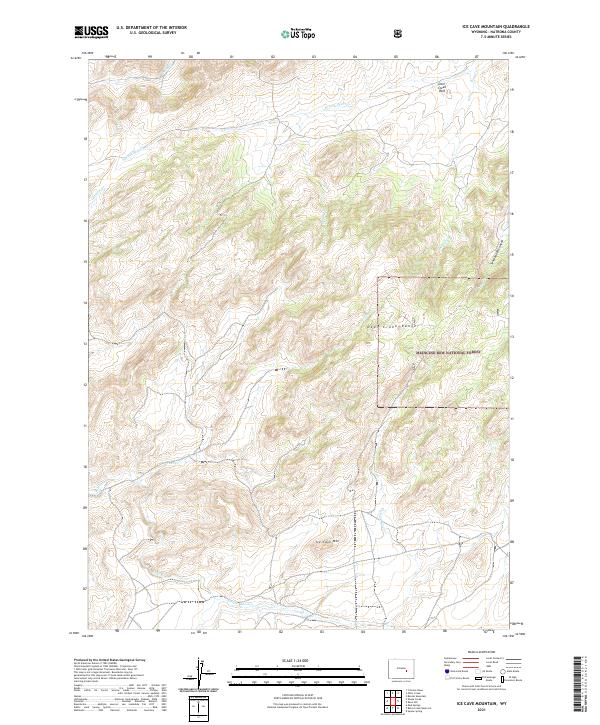
2021 Map of Ice Cave Mountain
USGS Topo · Published 2021About this map
Ice Cave Mtn serves as a prominent landmark in this high-altitude section of the Deer Creek Range, which sits primarily within the protected boundaries of the Medicine Bow National Forest. The landscape is defined by a dense network of watercourses that drain the surrounding slopes, including Smith Cr and W Fork Deer Cr in the northern reaches, and the headwaters of Bates Cr and E Fork Bates Cr in the south. The township lines for T30N and T31N intersect here, providing a clear reference for the Public Land Survey System across these drainage basins.
Find a feature on this map
20 named features on this map. Tap any name to fly to it.
Don’t see what you’re looking for? This feature index may not catch every label — zoom into the map to look around manually.
Map Details
Editions of this 2021 Ice Cave Mountain Map
This is the sole edition of this map. No revisions or reprints were ever made.
Other maps of this area

1955 · Casper
USGS Topo · 1:250,000

1958 · Casper
USGS Topo · 1:250,000

1959 · Squaw Spring
USGS Topo · 1:24,000

1959 · Bates Creek Reservoir
USGS Topo · 1:24,000

1960 · Crimson Dawn
USGS Topo · 1:24,000

1960 · Sheep Creek
USGS Topo · 1:24,000

1960 · Mud Springs
USGS Topo · 1:24,000

1960 · Ice Cave Mountain
USGS Topo · 1:24,000

1960 · Banner Mtn
USGS Topo · 1:24,000
1960 · Otter Creek
USGS Topo · 1:24,000