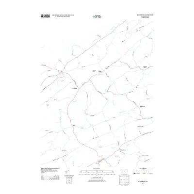
2013 Map of Ickesburg
USGS Topo · Published 2013About this map
Ickesburg and its surrounding hamlets occupy a landscape defined by parallel ridges and creek valleys. This survey of central Pennsylvania topography reveals a settlement pattern largely dictated by the terrain of Sherman Ridge and Limestone Ridge. The drainage of Buffalo Cr and its tributaries, including Little Buffalo Cr and Lutman Run, carves through the land, providing the corridors for historic thoroughfares like the Buffalo Trce and the Tuscarora Path. Rural communities such as Roseburg, Eshcol, and Mannsville are connected by a network of local roads and state routes, including Pa-17 and Shermans Valley Rd. The map also identifies culturally significant locations such as the small settlement of Little Germany and family-named landmarks like Asper Hill and Peach Ridge.
Find a feature on this map
70 named features on this map. Tap any name to fly to it.
Don’t see what you’re looking for? This feature index may not catch every label — zoom into the map to look around manually.
Map Details
Editions of this 2013 Ickesburg Map
This is the sole edition of this map. No revisions or reprints were ever made.
Other maps of this area

1907 · New Bloomfield
USGS Topo · 1:62,500

1907 · Millerstown
USGS Topo · 1:62,500

1925 · Mifflintown
USGS Topo · 1:48,000

1930 · Loysville
USGS Topo · 1:62,500

1933 · Loysville
USGS Topo · 1:62,500

1934 · Mifflintown
USGS Topo · 1:62,500

1937 · Mifflintown
USGS Topo · 1:62,500

1943 · Millerstown
USGS Topo · 1:62,500

1943 · New Bloomfield
USGS Topo · 1:62,500

1950 · Harrisburg
USGS Topo · 1:250,000
Featured Places
- Saville Township, PA
- Tyrone Township, PA
- Centre Township, PA
- Turbett Township, PA
- Tuscarora Township, PA