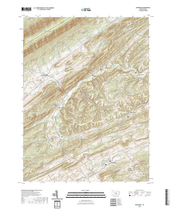
2023 Map of Ickesburg
USGS Topo · Published 2023About this map
The rolling terrain of central Perry County is defined by a series of parallel ridges, including Tuscarora Mountain and Raccoon Ridge, that channel the local road network and the flow of Buffalo Creek. This landscape is dotted with long-established rural hamlets such as Ickesburg, Roseburg, and Mannsville. These small communities serve as anchors for a network of historic burial grounds and congregations, from the Eshcol Memorial Cem in the north to the Little Germany Church Cem near the southern boundary. The map illustrates how local geography dictated settlement patterns, with roads like Raccoon Valley Rd and Shermans Valley Rd following the natural contours between the prominent heights of Hominy Ridge and Peach Ridge. This modern survey provides a clear view of the enduring rural character and genealogical landmarks of the region.
Find a feature on this map
58 named features on this map. Tap any name to fly to it.
Don’t see what you’re looking for? This feature index may not catch every label — zoom into the map to look around manually.
Map Details
Editions of this 2023 Ickesburg Map
This is the sole edition of this map. No revisions or reprints were ever made.
Other maps of this area

1907 · New Bloomfield
USGS Topo · 1:62,500

1907 · Millerstown
USGS Topo · 1:62,500

1925 · Mifflintown
USGS Topo · 1:48,000

1930 · Loysville
USGS Topo · 1:62,500

1933 · Loysville
USGS Topo · 1:62,500

1934 · Mifflintown
USGS Topo · 1:62,500

1937 · Mifflintown
USGS Topo · 1:62,500

1943 · Millerstown
USGS Topo · 1:62,500

1943 · New Bloomfield
USGS Topo · 1:62,500

1950 · Harrisburg
USGS Topo · 1:250,000