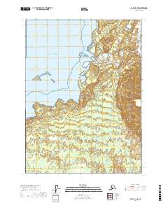
2017 Map of Icy Bay D-1 NW
USGS Topo · Published 2017About this map
The Gulf of Alaska defines the western edge of this coastal environment, where glacial runoff and oceanic tides meet in a complex network of braided waterways. The landscape is dominated by the sprawling deltas of the Yahtse River and the Caetani River, which weave through low-lying wetlands and alluvial flats. Offshore, the isolated Gulf Island sits within the protective boundaries of the Alaska Maritime National Wildlife Refuge, highlighting the region's role as a critical habitat for migratory species and marine life. This 2017 survey captures a remote wilderness largely untouched by permanent settlement, where the shifting courses of the Yahtse River suggest a dynamic, ever-changing coastline shaped by the powerful forces of the North Pacific.
Find a feature on this map
10 named features on this map. Tap any name to fly to it.
Don’t see what you’re looking for? This feature index may not catch every label — zoom into the map to look around manually.
Map Details
Editions of this 2017 Icy Bay D-1 NW Map
This is the sole edition of this map. No revisions or reprints were ever made.
Other maps of this area

1948 · Icy Bay D-2 and D-3
USGS Topo · 1:63,360

1950 · Bering Glacier
USGS Topo · 1:250,000

1950 · Icy Bay
USGS Topo · 1:250,000

1951 · Icy Bay D-2 and D-3
USGS Topo · 1:63,360

1951 · Icy Bay
USGS Topo · 1:250,000

1951 · Bering Glacier
USGS Topo · 1:250,000

1951 · Bering Glacier A-2
USGS Topo · 1:63,360
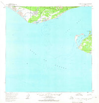
1959 · Icy Bay D-2 and D-3
USGS Topo · 1:63,360

1959 · Bering Glacier
USGS Topo · 1:250,000

1959 · Bering Glacier A-2
USGS Topo · 1:63,360