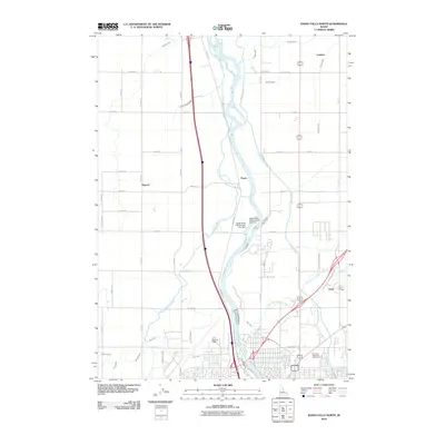
2010 Map of Idaho Falls North
USGS Topo · Published 2010About this map
The Snake River anchors this 2010 study of the northern reaches of Idaho Falls, where industrial water management and agricultural infrastructure define the landscape. The river is harnessed by the Upper Idaho Falls Number One Dam and Upper Idaho Falls Number Two Dam, feeding an intricate network of irrigation systems including the Great Western Canal, Harrison Canal, and Idaho Canal. These waterways supported the development of small rural communities such as Coltman, Osgood, and Payne. Near the urban edge, the Saint Leon Grange and Pinecrest Municipal Golf Course sit among the structured grid of rural roads. The proximity of Fanning Field to the river's path illustrates the historical convergence of transportation and water power in the Upper Snake River Valley, providing a clear record of how the region's early settlements like Orvin transitioned into the modern era.
Find a feature on this map
61 named features on this map. Tap any name to fly to it.
Don’t see what you’re looking for? This feature index may not catch every label — zoom into the map to look around manually.
Map Details
Editions of this 2010 Idaho Falls North Map
This is the sole edition of this map. No revisions or reprints were ever made.
Other maps of this area

1924 · Ammon
USGS Topo · 1:62,500

1948 · Woodville
USGS Topo · 1:24,000

1948 · Rigby
USGS Topo · 1:24,000

1948 · Lewisville
USGS Topo · 1:24,000

1948 · Idaho Falls North
USGS Topo · 1:24,000

1948 · Idaho Falls South
USGS Topo · 1:24,000

1948 · Ucon
USGS Topo · 1:24,000

1949 · Ucon
USGS Topo · 1:24,000

1949 · Idaho Falls North
USGS Topo · 1:24,000

1949 · Rigby
USGS Topo · 1:24,000