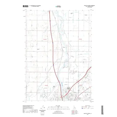
2020 Map of Idaho Falls North
USGS Topo · Published 2020About this map
The Snake River carves through the heart of this landscape, its waters diverted into an intricate network of irrigation systems that define the region's agricultural character. This complex hydrological web includes the Great Western Canal, Owners Mutual Canal, and the Mel Fieldings Ditch, illustrating a decades-old tradition of water management in the Snake River Valley. On the northern edge of Idaho Falls, the terrain transitions from urban infrastructure, including the Idaho Falls Regional Airport, to more dispersed rural settlements.
Find a feature on this map
83 named features on this map. Tap any name to fly to it.
Don’t see what you’re looking for? This feature index may not catch every label — zoom into the map to look around manually.
Map Details
Editions of this 2020 Idaho Falls North Map
This is the sole edition of this map. No revisions or reprints were ever made.
Other maps of this area

1924 · Ammon
USGS Topo · 1:62,500

1948 · Woodville
USGS Topo · 1:24,000

1948 · Rigby
USGS Topo · 1:24,000

1948 · Lewisville
USGS Topo · 1:24,000

1948 · Idaho Falls North
USGS Topo · 1:24,000

1948 · Idaho Falls South
USGS Topo · 1:24,000

1948 · Ucon
USGS Topo · 1:24,000

1949 · Ucon
USGS Topo · 1:24,000

1949 · Idaho Falls North
USGS Topo · 1:24,000

1949 · Rigby
USGS Topo · 1:24,000