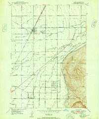
1948 Map of Idaho Falls South
USGS Topo · Published 1979About this map
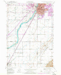
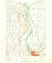
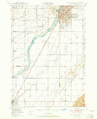
The Snake River corridor south of Idaho Falls is defined by a sophisticated gravity-fed irrigation network that transformed the high desert into a productive agricultural valley. A dense web of canals, including the Great Western Canal, Porter Canal, and Idaho Canal, fans out across the landscape, illustrating the region's total reliance on water engineering for its development. The settlement pattern follows this infrastructure, with local landmarks like New Sweden Sch and Stanton Sch serving dispersed farming families.
Find a feature on this map
69 named features on this map. Tap any name to fly to it.
Don’t see what you’re looking for? This feature index may not catch every label — zoom into the map to look around manually.
Map Details
Editions of this 1948 Idaho Falls South Map
3 editions found

Other maps of this area

1924 · Ammon
USGS Topo · 1:62,500

1948 · Woodville
USGS Topo · 1:24,000
1948 · Idaho Falls North
USGS Topo · 1:24,000
1948 · Idaho Falls South
USGS Topo · 1:24,000
1948 · Ucon
USGS Topo · 1:24,000
1949 · Ucon
USGS Topo · 1:24,000

1949 · Idaho Falls North
USGS Topo · 1:24,000

1949 · Roberts
USGS Topo · 1:62,500
1949 · Shattuck Butte
USGS Topo · 1:24,000

1950 · Shattuck Butte
USGS Topo · 1:24,000