
1948 Map of Idaho Falls South
USGS Topo · Published 1984About this map
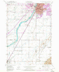
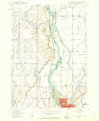
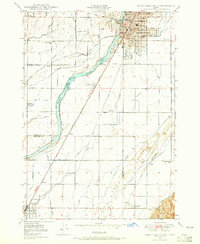
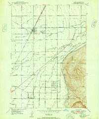
The Snake River defines this landscape, where a sophisticated network of irrigation canals supports agricultural expansion south of Idaho Falls. Engineering feats such as Dam 4672 and Dam 4654 manage the river's flow, feeding the Great Western Canal and Porter Canal to transform the arid surroundings. This 1948 survey shows the city's southward growth, anchored by institutional landmarks like the LDS Temple, Sacred Heart Hospital, and the sprawling Tautphaus Park.
Find a feature on this map
75 named features on this map. Tap any name to fly to it.
Don’t see what you’re looking for? This feature index may not catch every label — zoom into the map to look around manually.
Map Details
Editions of this 1948 Idaho Falls South Map
3 editions found
Other maps of this area

1924 · Ammon
USGS Topo · 1:62,500

1948 · Woodville
USGS Topo · 1:24,000
1948 · Idaho Falls North
USGS Topo · 1:24,000
1948 · Idaho Falls South
USGS Topo · 1:24,000
1948 · Ucon
USGS Topo · 1:24,000
1949 · Ucon
USGS Topo · 1:24,000

1949 · Idaho Falls North
USGS Topo · 1:24,000

1949 · Roberts
USGS Topo · 1:62,500
1949 · Shattuck Butte
USGS Topo · 1:24,000

1950 · Shattuck Butte
USGS Topo · 1:24,000