1968 Map of Idalia
USGS Topo · Published 1971About this map
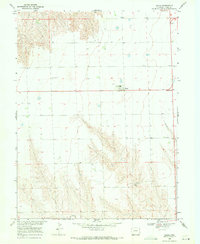
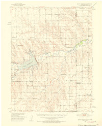
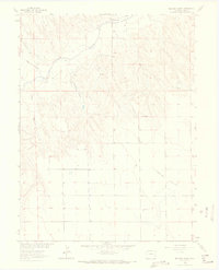
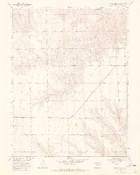
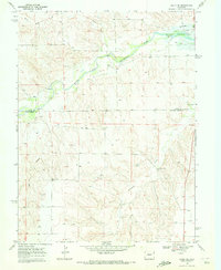
Idalia serves as the focal point of this Eastern Colorado landscape, captured during a period of agricultural development within the Missouri River Basin project. The settlement pattern is defined by a sparse but deliberate network of community landmarks, including the High Sch and a local Roadside Park. Beyond the immediate town site, the plains are etched by the drainage of Armknecht Creek and North Sand Creek, where the topography breaks into more complex draws and ridges. Local genealogy is anchored by the Lucas Memorial Cem to the west and St John Ch to the southeast. The map also documents the functional infrastructure of the late 1960s, noting several Well sites, a Gravel Pit, and a prominent Radio Tower that stand as isolated markers across the wide-open terrain of Yuma County.
Find a feature on this map
11 named features on this map. Tap any name to fly to it.
Don’t see what you’re looking for? This feature index may not catch every label — zoom into the map to look around manually.
Map Details
Editions of this 1968 Idalia Map
This is the sole edition of this map. No revisions or reprints were ever made.
Other maps of this area
1950 · Bonny Reservoir
USGS Topo · 1:62,500

1954 · Limon
USGS Topo · 1:250,000

1957 · Limon
USGS Topo · 1:250,000

1958 · Limon
USGS Topo · 1:250,000
1963 · Beecher Island
USGS Topo · 1:24,000

1963 · Wildcat Canyon
USGS Topo · 1:24,000

1968 · Vernon SW
USGS Topo · 1:24,000

1968 · Bonny Reservoir North
USGS Topo · 1:24,000
1968 · Spring Canyon
USGS Topo · 1:24,000
1969 · Idalia SE
USGS Topo · 1:24,000