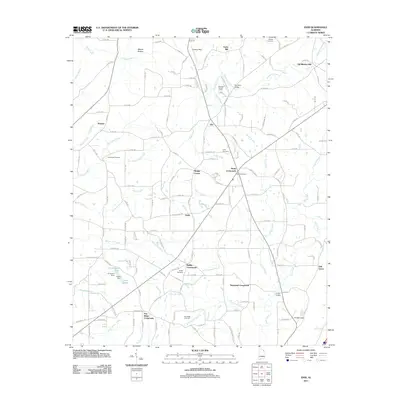
2011 Map of Ider
USGS Topo · Published 2011About this map
Ider serves as the central hub of this DeKalb County landscape, where numerous rural intersections such as Beaty Crossroads and Skaggs Corner anchor the community. The topography is defined by the drainages of Crow Creek and Town Creek, with early industrial sites like Old Blevins Mill and Yorks Mill situated along the northern watercourses. This 2011 survey documents a network of family-named landmarks and cemeteries, including Pea Ridge Cemetery and Weldon Cemetery, which provide critical waypoints for genealogists. The southern portion of the map transitions toward the high ground at Pea Ridge Crossroads and the descent into Troxel Gap. Water management is evident near the settlement of Shrader with J R Gilberts Lake and the associated J R Gilbert Dam, illustrating the local reliance on engineered reservoirs alongside natural branches like Hogskin Creek and Sandy Ford Creek.
Find a feature on this map
166 named features on this map. Tap any name to fly to it.
Don’t see what you’re looking for? This feature index may not catch every label — zoom into the map to look around manually.
Map Details
Editions of this 2011 Ider Map
This is the sole edition of this map. No revisions or reprints were ever made.
Other maps of this area

1886 · Stevenson
USGS Topo · 1:125,000

1892 · Stevenson
USGS Topo · 1:125,000

1895 · Stevenson
USGS Topo · 1:125,000

1936 · Trenton
USGS Topo · 1:24,000

1936 · Ider
USGS Topo · 1:24,000

1936 · Flat Rock
USGS Topo · 1:24,000

1936 · Dugout Valley
USGS Topo · 1:24,000

1936 · Sulphur Springs
USGS Topo · 1:24,000

1936 · Sylvania
USGS Topo · 1:24,000

1936 · Stevenson
USGS Topo · 1:24,000