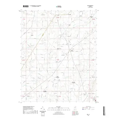
2020 Map of Ider
USGS Topo · Published 2020About this map
Sand Mountain dominates this portion of DeKalb County, where a network of rural settlements like Ider and Henagar are linked by a complex web of county roads. The landscape is defined by its watercourses, including the north-flowing Pond Cr and the winding Boydston Cr, which is crossed by Boydston Bridge. This 2020 map documents the enduring agricultural and residential patterns of the area, punctuated by numerous historic burial grounds such as Pilgrims Home Church Cem and Weldon Church Cem.
Find a feature on this map
168 named features on this map. Tap any name to fly to it.
Don’t see what you’re looking for? This feature index may not catch every label — zoom into the map to look around manually.
Map Details
Editions of this 2020 Ider Map
This is the sole edition of this map. No revisions or reprints were ever made.
Other maps of this area

1886 · Stevenson
USGS Topo · 1:125,000

1892 · Stevenson
USGS Topo · 1:125,000

1895 · Stevenson
USGS Topo · 1:125,000

1936 · Trenton
USGS Topo · 1:24,000

1936 · Ider
USGS Topo · 1:24,000

1936 · Flat Rock
USGS Topo · 1:24,000

1936 · Dugout Valley
USGS Topo · 1:24,000

1936 · Sulphur Springs
USGS Topo · 1:24,000

1936 · Sylvania
USGS Topo · 1:24,000

1936 · Stevenson
USGS Topo · 1:24,000