2024 Map of Ider
USGS Topo · Published 2024About this map
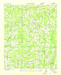
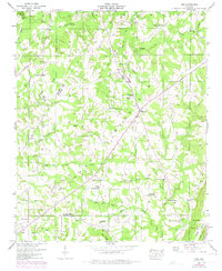
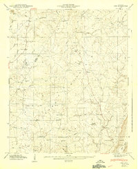
Yorks Mill and Old Blevins Mill stand as markers of a historical agrarian economy along the watercourses of DeKalb County. This 2024 map documents the high plateau of Sand Mountain and the distinct terrain of Pea Ridge, where a network of crossroads settlements like Beaty Crossroads, Skaggs Corner, and Biddle Crossroads continues to define the local geography. The area is dense with family-named burial grounds and local landmarks, including the Smith Family Cem, Townson Cem, and Fuller Cem, which offer significant value for genealogists tracing lineage in the region around Ider and Henagar. The drainage patterns are clearly defined by Boydston Creek, Koger Creek, and the headwaters of South Sauty Creek, illustrating the natural irrigation that supported the local homesteads and milling sites throughout the early 21st century.
Find a feature on this map
142 named features on this map. Tap any name to fly to it.
Don’t see what you’re looking for? This feature index may not catch every label — zoom into the map to look around manually.
Map Details
Editions of this 2024 Ider Map
This is the sole edition of this map. No revisions or reprints were ever made.
Historical Maps of Yorks Mill Through Time
4 maps found