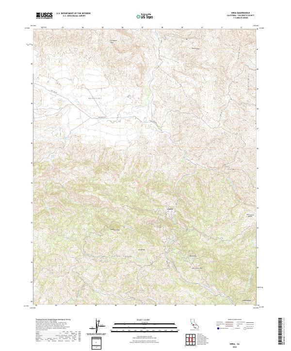
2022 Map of Idria
USGS Topo · Published 2022About this map
The Idria settlement sits deep within the high elevations of the Diablo Range, surrounded by a complex system of peaks and drainages. This high-country landscape is defined by its topographical prominence, featuring notable summits such as Sampson Peak, Idria Peak, and San Carlos Peak. The terrain is divided into distinct upland regions including the Griswold Hills, Tumey Hills, and Ciervo Hills, which overlook deep-cut features like Larious Canyon.
Find a feature on this map
34 named features on this map. Tap any name to fly to it.
Don’t see what you’re looking for? This feature index may not catch every label — zoom into the map to look around manually.
Map Details
Editions of this 2022 Idria Map
This is the sole edition of this map. No revisions or reprints were ever made.
Other maps of this area

1913 · Panoche
USGS Topo · 1:125,000

1915 · Priest Valley
USGS Topo · 1:125,000

1923 · Monocline Ridge
USGS Topo · 1:31,680

1943 · New Idria
USGS Topo · 1:62,500

1943 · Hernandez Valley
USGS Topo · 1:62,500

1944 · Hernandez Valley
USGS Topo · 1:62,500

1944 · Panoche Valley
USGS Topo · 1:62,500

1948 · Santa Cruz
USGS Topo · 1:250,000

1955 · Santa Cruz
USGS Topo · 1:250,000
1955 · Monocline Ridge
USGS Topo · 1:24,000