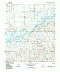
1984 Map of Ikpikpuk River A-1
USGS Topo · Published 1985About this map
The Colville River carves a massive, braided path across this North Slope landscape, defined by the towering Ninuluk Bluff and the surrounding administrative boundaries of the National Petroleum Reserve in Alaska. This 1984 edition, based on earlier aerial photography, captures a wilderness shaped by drainage and high-latitude topography where names like Kimikpak Ridge and Siksikpak Ridge rise above the permafrost-dotted plains.
Find a feature on this map
12 named features on this map. Tap any name to fly to it.
Don’t see what you’re looking for? This feature index may not catch every label — zoom into the map to look around manually.
Map Details
Editions of this 1984 Ikpikpuk River A-1 Map
This is the sole edition of this map. No revisions or reprints were ever made.
Other maps of this area

1951 · Ikpikpuk River
USGS Topo · 1:250,000

1951 · Chandler Lake
USGS Topo · 1:250,000

1951 · Killik River
USGS Topo · 1:250,000

1952 · Umiat
USGS Topo · 1:250,000

1955 · Umiat A-5
USGS Topo · 1:63,360

1955 · Umiat B-5
USGS Topo · 1:63,360

1956 · Chandler Lake
USGS Topo · 1:250,000

1956 · Killik River
USGS Topo · 1:250,000

1956 · Ikpikpuk River
USGS Topo · 1:250,000

1956 · Umiat
USGS Topo · 1:250,000