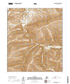
2020 Map of Ikpikpuk River A-1 SE
USGS Topo · Published 2020About this map
Ninuluk Creek and its tributary, South Fork Ninuluk Creek, snake through this unpopulated expanse of the North Slope. The terrain is defined by complex contouring, illustrating the drainage patterns of the Alaskan interior as the waterways transition through township boundaries t4s r5w, t4s r6w, and t5s r5w. These land divisions, though largely devoid of structures or settlements, reflect the systematic Public Land Survey System applied to this remote Arctic region. The map provides a detailed view of the watershed before these waters eventually join the Ikpikpuk River system, offering a precise look at a landscape defined by hydrology rather than human infrastructure.
Find a feature on this map
6 named features on this map. Tap any name to fly to it.
Don’t see what you’re looking for? This feature index may not catch every label — zoom into the map to look around manually.
Map Details
Editions of this 2020 Ikpikpuk River A-1 SE Map
This is the sole edition of this map. No revisions or reprints were ever made.
Other maps of this area

1951 · Ikpikpuk River
USGS Topo · 1:250,000

1951 · Chandler Lake
USGS Topo · 1:250,000

1951 · Killik River
USGS Topo · 1:250,000

1952 · Umiat
USGS Topo · 1:250,000

1955 · Umiat A-5
USGS Topo · 1:63,360

1956 · Chandler Lake
USGS Topo · 1:250,000

1956 · Killik River
USGS Topo · 1:250,000

1956 · Ikpikpuk River
USGS Topo · 1:250,000

1956 · Umiat
USGS Topo · 1:250,000

1964 · Chandler Lake
USGS Topo · 1:250,000