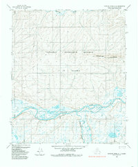
1984 Map of Ikpikpuk River A-4
USGS Topo · Published 1985About this map
The Colville River carves a complex course through this portion of the National Petroleum Reserve in Alaska, characterized by an intricate network of braided channels and wetlands. To the north, the Kigalik River meanders across the tundra, while the Kurupa River flows northward to join the Colville. The topography is defined by significant elevations such as Knifeblade Ridge, providing a stark contrast to the low-lying river plains. A notable human element in this wilderness is the Tractor Trail, which cuts across the landscape near Frisco, indicating the essential transport methods used for exploration and resource management in the Arctic. This 1984 survey represents the landscape as it was documented from 1973 aerial photography, capturing the raw geography of the North Slope before later shifts in environmental and industrial activity.
Find a feature on this map
13 named features on this map. Tap any name to fly to it.
Don’t see what you’re looking for? This feature index may not catch every label — zoom into the map to look around manually.
Map Details
Editions of this 1984 Ikpikpuk River A-4 Map
This is the sole edition of this map. No revisions or reprints were ever made.
Other maps of this area

1951 · Ikpikpuk River
USGS Topo · 1:250,000

1951 · Killik River
USGS Topo · 1:250,000

1956 · Killik River
USGS Topo · 1:250,000

1956 · Ikpikpuk River
USGS Topo · 1:250,000

1984 · Killik River D-5
USGS Topo · 1:63,360
1984 · Ikpikpuk River A-5
USGS Topo · 1:63,360

1984 · Ikpikpuk River A-3
USGS Topo · 1:63,360
1985 · Ikpikpuk River B-4
USGS Topo · 1:63,360

1985 · Ikpikpuk River B-3
USGS Topo · 1:63,360
1985 · Ikpikpuk River B-5
USGS Topo · 1:63,360