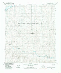
1985 Map of Ikpikpuk River B-5
USGS Topo · Published 1985About this map
The National Petroleum Reserve in Alaska dominates this landscape, reflecting a mid-1980s period of federal land management and resource evaluation in the North Slope Borough. This specific area is defined by its drainage systems, most notably the meandering course of the Kigalik River which winds across the southern half of the sheet, and the Titaluk River in the northwest corner. The terrain is structured by the Base Line, a critical surveying marker for the Township and Range system in this expansive environment. Without roads or permanent settlements, the map provides an exacting record of the natural hydrology and topographical relief as it stood prior to modern industrial shifts in the Arctic interior.
Find a feature on this map
4 named features on this map. Tap any name to fly to it.
Don’t see what you’re looking for? This feature index may not catch every label — zoom into the map to look around manually.
Map Details
Editions of this 1985 Ikpikpuk River B-5 Map
This is the sole edition of this map. No revisions or reprints were ever made.
Other maps of this area

1951 · Lookout Ridge
USGS Topo · 1:250,000

1951 · Ikpikpuk River
USGS Topo · 1:250,000

1956 · Lookout Ridge
USGS Topo · 1:250,000

1956 · Ikpikpuk River
USGS Topo · 1:250,000
1984 · Ikpikpuk River A-4
USGS Topo · 1:63,360
1984 · Lookout Ridge A-1
USGS Topo · 1:63,360
1984 · Ikpikpuk River A-5
USGS Topo · 1:63,360
1985 · Ikpikpuk River B-4
USGS Topo · 1:63,360
1985 · Lookout Ridge C-1
USGS Topo · 1:63,360
1985 · Lookout Ridge B-1
USGS Topo · 1:63,360