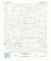
1984 Map of Lookout Ridge A-1
USGS Topo · Published 1985About this map
The National Petroleum Reserve in Alaska dominates this 1980s landscape, representing a remote arctic region defined by its hydrology and survey history. The meandering path of the Awuna River flows through the central portion of the quadrangle, while the Lookout River emerges in the southwest. A sparse human presence is indicated by a Tractor Trail crossing the northern terrain, likely used for seasonal transit across the tundra. Isolated points such as Reckon and Tumid serve as specific landmarks in an otherwise open expanse of unmarked and unsurveyed land lines, as predetermined by the Bureau of Land Management. The map reflects a period of intensive scientific and photogrammetric study of the North Slope, capturing the pristine drainage patterns and subtle elevation shifts of the Brooks Range foothills.
Find a feature on this map
8 named features on this map. Tap any name to fly to it.
Don’t see what you’re looking for? This feature index may not catch every label — zoom into the map to look around manually.
Map Details
Editions of this 1984 Lookout Ridge A-1 Map
This is the sole edition of this map. No revisions or reprints were ever made.
Other maps of this area

1951 · Lookout Ridge
USGS Topo · 1:250,000

1951 · Ikpikpuk River
USGS Topo · 1:250,000

1951 · Howard Pass
USGS Topo · 1:250,000

1951 · Killik River
USGS Topo · 1:250,000

1956 · Lookout Ridge
USGS Topo · 1:250,000

1956 · Howard Pass
USGS Topo · 1:250,000

1956 · Killik River
USGS Topo · 1:250,000

1956 · Ikpikpuk River
USGS Topo · 1:250,000

1984 · Howard Pass D-1
USGS Topo · 1:63,360

1984 · Killik River D-5
USGS Topo · 1:63,360