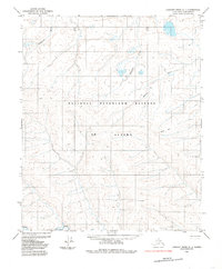
1985 Map of Lookout Ridge C-1
USGS Topo · Published 1985About this map
National Petroleum Reserve in Alaska dominates this landscape, showing a vast tract of the North Slope defined by its complex drainage networks and remote industrial footprints. The Titaluk River winds across the southern reaches of the quadrangle, while the northern terrain is carved by the Topagorak River, Ivhuktak Creek, and the Oumalik River. These waterways reveal a low-lying tundra environment where seasonal thaw and permafrost dictate the movement of both water and people.
Find a feature on this map
9 named features on this map. Tap any name to fly to it.
Don’t see what you’re looking for? This feature index may not catch every label — zoom into the map to look around manually.
Map Details
Editions of this 1985 Lookout Ridge C-1 Map
This is the sole edition of this map. No revisions or reprints were ever made.
Other maps of this area

1951 · Lookout Ridge
USGS Topo · 1:250,000

1951 · Ikpikpuk River
USGS Topo · 1:250,000

1956 · Lookout Ridge
USGS Topo · 1:250,000

1956 · Ikpikpuk River
USGS Topo · 1:250,000
1984 · Ikpikpuk River D-5
USGS Topo · 1:63,360
1984 · Lookout Ridge D-1
USGS Topo · 1:63,360
1984 · Lookout Ridge D-2
USGS Topo · 1:63,360
1985 · Lookout Ridge B-2
USGS Topo · 1:63,360
1985 · Lookout Ridge B-1
USGS Topo · 1:63,360
1985 · Ikpikpuk River C-5
USGS Topo · 1:63,360