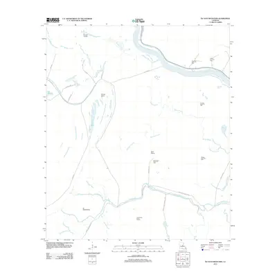
2012 Map of Ile Natchitoches
USGS Topo · Published 2012About this map
The Red River winds through a complex network of waterways and industrial activity in this modern survey of Avoyelles Parish. This landscape is defined by its low-lying hydrology, where names like Lac Long, Lac Ophelia, and Lac Volee represent the remnants of shifting river channels. The interior is characterized by the presence of numerous extraction sites, including the Natchitoches Island Oil Field and the Milligan Bayou Oil Field, indicating a rural economy heavily reliant on petroleum resources.
Find a feature on this map
39 named features on this map. Tap any name to fly to it.
Don’t see what you’re looking for? This feature index may not catch every label — zoom into the map to look around manually.
Map Details
Editions of this 2012 Ile Natchitoches Map
This is the sole edition of this map. No revisions or reprints were ever made.
Other maps of this area

1935 · Tooleys
USGS Topo · 1:62,500

1939 · Artonish
USGS Topo · 1:62,500

1939 · Deer Park
USGS Topo · 1:62,500

1941 · Voorhies
USGS Topo · 1:62,500

1941 · Tooleys
USGS Topo · 1:62,500

1953 · Natchez
USGS Topo · 1:250,000

1954 · Artonish
USGS Topo · 1:62,500

1955 · Artonish
USGS Topo · 1:62,500

1956 · Natchez
USGS Topo · 1:250,000

1958 · Artonish
USGS Topo · 1:62,500