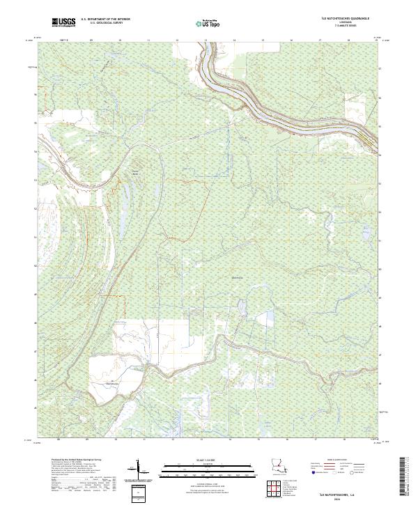
2024 Map of Ile Natchitoches
USGS Topo · Published 2024About this map
The low-lying alluvial plains of Avoyelles Parish are defined here by the winding course of the Red River and a dense network of sluggish waterways. Much of the western landscape is protected within the Lake Ophelia National Wildlife Refuge, where a labyrinth of oxbow lakes and coulees, such as Lac a Madame Lee and Lac Poisson Arme, marks the historical migrations of the river system. These features, along with the Grande Coulee and Bayou Sans Facon, illustrate the complex hydrology of the central Louisiana basin.
Find a feature on this map
48 named features on this map. Tap any name to fly to it.
Don’t see what you’re looking for? This feature index may not catch every label — zoom into the map to look around manually.
Map Details
Editions of this 2024 Ile Natchitoches Map
This is the sole edition of this map. No revisions or reprints were ever made.
Other maps of this area

1935 · Tooleys
USGS Topo · 1:62,500

1939 · Artonish
USGS Topo · 1:62,500

1939 · Deer Park
USGS Topo · 1:62,500

1941 · Voorhies
USGS Topo · 1:62,500

1941 · Tooleys
USGS Topo · 1:62,500

1953 · Natchez
USGS Topo · 1:250,000

1954 · Artonish
USGS Topo · 1:62,500

1955 · Artonish
USGS Topo · 1:62,500

1956 · Natchez
USGS Topo · 1:250,000

1958 · Artonish
USGS Topo · 1:62,500