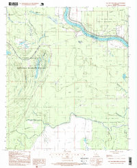
1996 Map of Ile Natchitoches
USGS Topo · Published 1999About this map
The Red River creates a meandering border between Concordia and Avoyelles Parishes, defining a landscape of wetlands and conservation lands in the mid-1990s. This territory is heavily managed for preservation, dominated by the Lake Ophelia National Wildlife Refuge and the Natchitoches Wildlife Management Area. The map reveals a complex hydraulic system of bayous and lakes, from Lac à Madame Lee in the north to the Bayou De L'Isle and Ile Natchitoches Bayou further south. While much of the land is dedicated to wildlife, the presence of the Catfish Bayou Oil Field and various dispersed drill sites indicates the active intersection of natural resource extraction and environmental protection. Openings in the bottomland hardwood forest are identified by names like Wolf Prairie and Pointe Basse, reflecting a terrain shaped by centuries of river movement and flooding.
Find a feature on this map
33 named features on this map. Tap any name to fly to it.
Don’t see what you’re looking for? This feature index may not catch every label — zoom into the map to look around manually.
Map Details
Editions of this 1996 Ile Natchitoches Map
This is the sole edition of this map. No revisions or reprints were ever made.
Other maps of this area

1935 · Tooleys
USGS Topo · 1:62,500

1939 · Artonish
USGS Topo · 1:62,500

1939 · Deer Park
USGS Topo · 1:62,500

1941 · Voorhies
USGS Topo · 1:62,500

1941 · Tooleys
USGS Topo · 1:62,500

1953 · Natchez
USGS Topo · 1:250,000

1954 · Artonish
USGS Topo · 1:62,500

1955 · Artonish
USGS Topo · 1:62,500

1956 · Natchez
USGS Topo · 1:250,000

1958 · Artonish
USGS Topo · 1:62,500