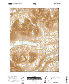
2018 Map of Iliamna A-5 SE
USGS Topo · Published 2018About this map
McNeil Lake sits at the center of this drainage landscape on the Kenai Peninsula, where high-elevation headwaters feed into complex river systems. The northern portion of the quadrangle is dominated by the Paint River and its primary tributaries, including the Middle Fork Paint River and the S Fork Paint River. This terrain is defined by steep elevation changes, with numerous small drainages like Crevice Cr and Kenty Cr cutting through the uplands. The southern half of the map is shaped by the McNeil River, which flows eastward toward the coast. This 2018 survey illustrates the untouched hydrological patterns of the region, emphasizing the connectivity between alpine lakes and the larger river valleys that dictate the movement of water across this part of Alaska.
Find a feature on this map
11 named features on this map. Tap any name to fly to it.
Don’t see what you’re looking for? This feature index may not catch every label — zoom into the map to look around manually.
Map Details
Editions of this 2018 Iliamna A-5 SE Map
This is the sole edition of this map. No revisions or reprints were ever made.
Other maps of this area

1948 · Mt Katmai
USGS Topo · 1:250,000

1951 · Mt Katmai
USGS Topo · 1:250,000

1951 · Iliamna A-5
USGS Topo · 1:63,360

1951 · Iliamna A-4
USGS Topo · 1:63,360

1951 · Mount Katmai D-2
USGS Topo · 1:63,360

1951 · Mount Katmai D-3
USGS Topo · 1:63,360

1952 · Iliamna
USGS Topo · 1:250,000

1952 · Iliamna A-4
USGS Topo · 1:63,360

1952 · Iliamna A-5
USGS Topo · 1:63,360

1957 · Iliamna
USGS Topo · 1:250,000