
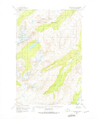
1951 Map of Mount Katmai D-2
USGS Topo · Published 1956About this map
Glacial ice and high-altitude basins dominate the interior of this mid-century survey of the Alaska Range. The Kamishak River serves as a primary drainage corridor in the southeast, winding through a broad valley floor toward the coast. Higher in the mountains, the Little Kamishak River cuts through a deep canyon, its course fed by numerous unnamed tributaries and snowfields. The terrain is marked by significant topographical relief, with the Mc Neil River draining the northern slopes and Strike Creek carving a narrow path through the central uplands. This 1951 documentation, based on aerial photographs from the U.S. Army Corps of Engineers, provides a detailed record of the glacial extent and drainage patterns before modern climatic shifts altered the landscape.
Find a feature on this map
4 named features on this map. Tap any name to fly to it.
Don’t see what you’re looking for? This feature index may not catch every label — zoom into the map to look around manually.
Map Details
Editions of this 1951 Mount Katmai D-2 Map
2 editions found
Other maps of this area

1948 · Mt Katmai
USGS Topo · 1:250,000

1951 · Mt Katmai
USGS Topo · 1:250,000

1951 · Iliamna A-5
USGS Topo · 1:63,360

1951 · Iliamna A-4
USGS Topo · 1:63,360

1951 · Mount Katmai C-3
USGS Topo · 1:63,360

1951 · Mount Katmai D-1
USGS Topo · 1:63,360

1951 · Mount Katmai C-2
USGS Topo · 1:63,360

1951 · Mount Katmai D-3
USGS Topo · 1:63,360

1951 · Mount Katmai C-1
USGS Topo · 1:63,360

1952 · Iliamna
USGS Topo · 1:250,000