
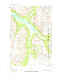
1951 Map of Mount Katmai D-3
USGS Topo · Published 1956About this map
Kulik Lake dominates this mid-century topographic survey of the Alaska Range, stretching diagonally across the terrain within the Katmai region. Surveyed using aerial photographs from 1951, the map captures a landscape defined by dramatic elevation changes and alpine glacial features before more modern climate shifts or expanded park infrastructure. To the northeast, the waters of Pirate Lake and the headwaters of the McNeil River emerge from high-altitude basins, illustrating the complex hydrology of the southwestern Alaska interior. The absence of roads or established settlements on this sheet highlights the wilderness character of the area during the early 1950s, emphasizing the natural drainage patterns and landforms that would later become focal points for conservation and environmental study in the Lake and Peninsula Borough.
Find a feature on this map
3 named features on this map. Tap any name to fly to it.
Don’t see what you’re looking for? This feature index may not catch every label — zoom into the map to look around manually.
Map Details
Editions of this 1951 Mount Katmai D-3 Map
2 editions found
Other maps of this area

1948 · Mt Katmai
USGS Topo · 1:250,000

1951 · Mt Katmai
USGS Topo · 1:250,000

1951 · Iliamna A-5
USGS Topo · 1:63,360

1951 · Mount Katmai C-3
USGS Topo · 1:63,360

1951 · Mount Katmai C-4
USGS Topo · 1:63,360

1951 · Mount Katmai C-2
USGS Topo · 1:63,360

1951 · Mount Katmai D-4
USGS Topo · 1:63,360

1951 · Mount Katmai D-2
USGS Topo · 1:63,360

1951 · Iliamna A-6
USGS Topo · 1:63,360

1952 · Iliamna
USGS Topo · 1:250,000