
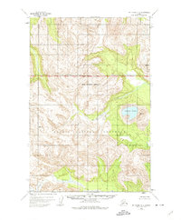
1951 Map of Mount Katmai C-1
USGS Topo · Published 1956About this map
The dramatic Kaguyak Volcano (Crater Lake) dominates the eastern landscape of this mid-century survey, a period when the area was managed as part of the Katmai National Monument. The map illustrates the complex drainage systems of the Big River and Ninagiak River, where multiple branches weave through the glacially-carved valleys. This 1951 documentation captures the terrain before its eventual redesignation as a national park, showing the established National Monument Boundary as it stood during the early post-war era of Alaskan territorial mapping. The topography, derived from 1951 aerial photography, provides a precise record of the caldera and the high ridges that define this volcanic region of the Alaska Peninsula.
Find a feature on this map
6 named features on this map. Tap any name to fly to it.
Don’t see what you’re looking for? This feature index may not catch every label — zoom into the map to look around manually.
Map Details
Editions of this 1951 Mount Katmai C-1 Map
2 editions found
Other maps of this area

1948 · Mt Katmai
USGS Topo · 1:250,000

1951 · Mt Katmai
USGS Topo · 1:250,000

1951 · Afognak C-6
USGS Topo · 1:63,360

1951 · Mount Katmai D-1
USGS Topo · 1:63,360

1951 · Mount Katmai C-2
USGS Topo · 1:63,360

1951 · Mount Katmai D-2
USGS Topo · 1:63,360

1951 · Mount Katmai B-1
USGS Topo · 1:63,360

1951 · Mount Katmai B-2
USGS Topo · 1:63,360

1951 · Afognak D-6
USGS Topo · 1:63,360

1952 · Afognak
USGS Topo · 1:250,000