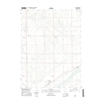
2016 Map of Iliff
USGS Topo · Published 2016About this map
The town of Iliff and the smaller clusters of Selma and Griff define the settlement pattern of this Logan County landscape along the South Platte River. The area is characterized by a sophisticated network of water management, vital for high-plains agriculture. Major infrastructure like the Iliff Platte Valley Ditch, Lone Tree Ditch, and the North Sterling Outlet Canal trace the contours of the valley, feeding into storage areas like Breidenbach Reservoir. North of the river, the terrain rises into draws and creeks such as Trap Draw, Sevenmile Creek, and Lewis Creek. This map documents the rural road grid, including Railroad Avenue and Logan Avenue, which parallel the historical rail corridor that facilitated the region’s growth. These features illustrate the enduring relationship between the river, irrigation engineering, and the small communities that emerged to support local industry.
Find a feature on this map
33 named features on this map. Tap any name to fly to it.
Don’t see what you’re looking for? This feature index may not catch every label — zoom into the map to look around manually.
Map Details
Editions of this 2016 Iliff Map
This is the sole edition of this map. No revisions or reprints were ever made.
Other maps of this area
1951 · Sterling North
USGS Topo · 1:24,000
1951 · Galien
USGS Topo · 1:24,000
1951 · Iliff
USGS Topo · 1:24,000
1951 · Padroni NW
USGS Topo · 1:24,000
1952 · Padroni
USGS Topo · 1:24,000
1953 · Peetz
USGS Topo · 1:24,000
1953 · Proctor
USGS Topo · 1:24,000
1953 · Haystack Butte
USGS Topo · 1:24,000

1954 · Sterling
USGS Topo · 1:250,000

1958 · Sterling
USGS Topo · 1:250,000