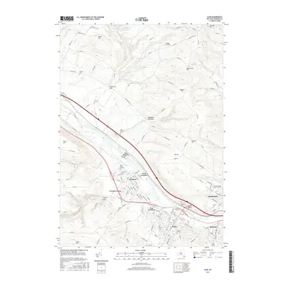
2016 Map of Ilion
USGS Topo · Published 2016About this map
The industrial corridor of the Mohawk Valley is captured in detail, centered on the historic manufacturing towns of Ilion, Frankfort, and Mohawk. This 2016 survey shows the enduring importance of the Erie Canal and Mohawk River as they parallel the major rail and highway routes through the valley floor. The map highlights the transition from the densely settled riverbanks to the surrounding highlands, including Beech Hill and the dramatic topography of Frankfort Gorge. Local history is preserved through numerous burial grounds like Saint Agnes Cem and Armory Hill Cem, as well as established institutions such as Herkimer County Community College. Smaller hamlets like East Schuyler and North Frankfort are visible, along with landmarks such as the Moss Road Bridge, reflecting the layer of infrastructure that has developed over centuries of transport history in this vital New York passage.
Find a feature on this map
138 named features on this map. Tap any name to fly to it.
Don’t see what you’re looking for? This feature index may not catch every label — zoom into the map to look around manually.
Map Details
Editions of this 2016 Ilion Map
This is the sole edition of this map. No revisions or reprints were ever made.
Other maps of this area

1898 · Utica
USGS Topo · 1:62,500

1900 · Little Falls
USGS Topo · 1:62,500

1900 · Utica
USGS Topo · 1:62,500

1903 · Richfield Springs
USGS Topo · 1:62,500

1903 · Little Falls
USGS Topo · 1:62,500

1907 · Winfield
USGS Topo · 1:62,500

1939 · Little Falls
USGS Topo · 1:62,500

1943 · Newport
USGS Topo · 1:24,000

1943 · Utica East
USGS Topo · 1:24,000

1943 · Jordanville
USGS Topo · 1:24,000