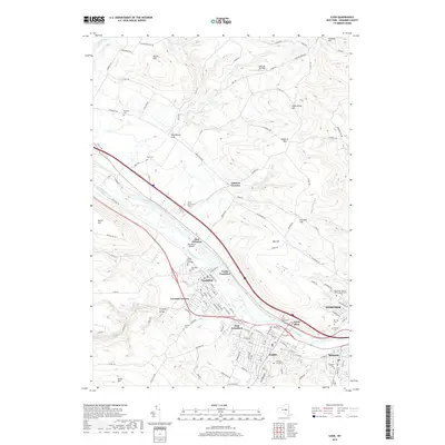
2019 Map of Ilion
USGS Topo · Published 2019About this map
The Mohawk River and the historic Erie Canal define the industrial and transport geography of this Mohawk Valley corridor. Centered on the village of Ilion, the landscape shows a dense cluster of settlements including Frankfort, Mohawk, and Herkimer, where high-ground ridges like Hasenclever Hill and Osborne Hill constrict the valley floor. This geography forced the development of tight-knit communities and shared infrastructure, such as the Moss Road Bridge and the Railroad Street corridor. Family history and local heritage are well-preserved in the numerous burial grounds spanning the hillsides, from Budlong Cem and Rose Cem in the north to the Saint Agnes Cem and Mohawk Cem further south. Modern institutional presence is noted at the Herkimer County Community College, while the Mohawk Air Park occupies the northern heights.
Find a feature on this map
130 named features on this map. Tap any name to fly to it.
Don’t see what you’re looking for? This feature index may not catch every label — zoom into the map to look around manually.
Map Details
Editions of this 2019 Ilion Map
This is the sole edition of this map. No revisions or reprints were ever made.
Other maps of this area

1898 · Utica
USGS Topo · 1:62,500

1900 · Little Falls
USGS Topo · 1:62,500

1900 · Utica
USGS Topo · 1:62,500

1903 · Richfield Springs
USGS Topo · 1:62,500

1903 · Little Falls
USGS Topo · 1:62,500

1907 · Winfield
USGS Topo · 1:62,500

1939 · Little Falls
USGS Topo · 1:62,500

1943 · Newport
USGS Topo · 1:24,000

1943 · Utica East
USGS Topo · 1:24,000

1943 · Jordanville
USGS Topo · 1:24,000