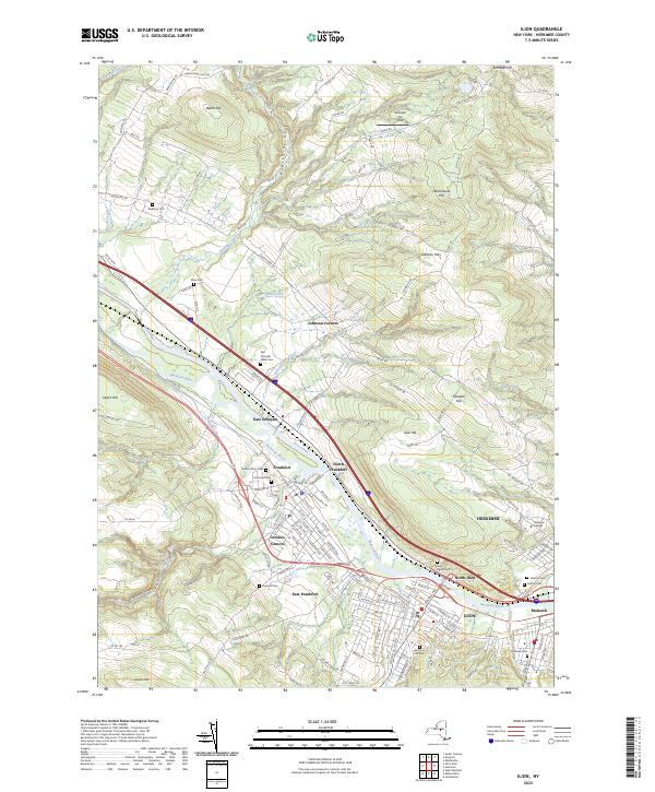
2023 Map of Ilion
USGS Topo · Published 2023About this map
The Mohawk River and the parallel course of the Erie Canal anchor this geographic study of the Mohawk Valley's industrial heartland. The dense settlements of Frankfort, Ilion, and Herkimer line the valley floor, showing the historical importance of the river corridor for transportation and commerce. Above the valley, the terrain rises sharply into named heights like Hasenclever Hill and Osborne Hill, where the land use shifts toward rural roads and family-named landmarks.
Find a feature on this map
130 named features on this map. Tap any name to fly to it.
Don’t see what you’re looking for? This feature index may not catch every label — zoom into the map to look around manually.
Map Details
Editions of this 2023 Ilion Map
This is the sole edition of this map. No revisions or reprints were ever made.
Other maps of this area

1898 · Utica
USGS Topo · 1:62,500

1900 · Little Falls
USGS Topo · 1:62,500

1900 · Utica
USGS Topo · 1:62,500

1903 · Richfield Springs
USGS Topo · 1:62,500

1903 · Little Falls
USGS Topo · 1:62,500

1907 · Winfield
USGS Topo · 1:62,500

1939 · Little Falls
USGS Topo · 1:62,500

1943 · Newport
USGS Topo · 1:24,000

1943 · Utica East
USGS Topo · 1:24,000

1943 · Jordanville
USGS Topo · 1:24,000