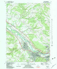
1982 Map of Ilion
USGS Topo · Published 1983About this map
The Mohawk River corridor serves as the industrial and transit spine for this Mohawk Valley landscape, where the Erie Canal and Conrail rail lines parallel the waterway. The dense urban centers of Ilion, Frankfort, and Mohawk are tightly clustered along the valley floor, showing a mature infrastructure of schools like Barringer Rd Sch and public landmarks including the City Hall and Hospital.
Find a feature on this map
88 named features on this map. Tap any name to fly to it.
Don’t see what you’re looking for? This feature index may not catch every label — zoom into the map to look around manually.
Map Details
Editions of this 1982 Ilion Map
This is the sole edition of this map. No revisions or reprints were ever made.
Other maps of this area

1898 · Utica
USGS Topo · 1:62,500

1900 · Little Falls
USGS Topo · 1:62,500

1900 · Utica
USGS Topo · 1:62,500

1903 · Richfield Springs
USGS Topo · 1:62,500

1903 · Little Falls
USGS Topo · 1:62,500

1907 · Winfield
USGS Topo · 1:62,500

1939 · Little Falls
USGS Topo · 1:62,500

1943 · Newport
USGS Topo · 1:24,000

1943 · Utica East
USGS Topo · 1:24,000

1943 · Jordanville
USGS Topo · 1:24,000