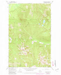
1966 Map of Illabot Peaks
USGS Topo · Published 1982About this map
Illabot Peaks anchor this mountainous landscape within the Mt Baker-Snoqualmie National Forest, where a network of high-altitude alpine lakes defines the wilderness character of Skagit County. The 1966 field data, later updated in 1982, reveals a drainage system where Illabot Creek and Marten Creek carve through steep topography. Settlement is nonexistent here, with the human footprint limited to forest infrastructure like the Cascade Rockport Road and Illabot Pks Road tracing the lower elevations.
Find a feature on this map
28 named features on this map. Tap any name to fly to it.
Don’t see what you’re looking for? This feature index may not catch every label — zoom into the map to look around manually.
Map Details
Editions of this 1966 Illabot Peaks Map
4 editions found
Other maps of this area

1899 · Glacier Peak
USGS Topo · 1:125,000

1899 · Stillaguamish
USGS Topo · 1:125,000

1901 · Glacier Peak
USGS Topo · 1:125,000

1901 · Stilaguamish
USGS Topo · 1:125,000

1909 · Mt Baker
USGS Topo · 1:192,000

1915 · Mt. Baker
USGS Topo · 1:250,000

1952 · Lake Shannon
USGS Topo · 1:62,500

1953 · Marblemount
USGS Topo · 1:62,500

1955 · Concrete
USGS Topo · 1:250,000

1958 · Concrete
USGS Topo · 1:250,000