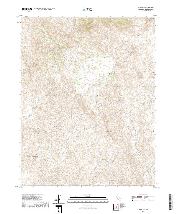
2021 Map of Illinois Hill
USGS Topo · Published 2021About this map
White Rock Cem sits as a quiet landmark within this high-elevation landscape of the Sierra Nevada foothills, situated just south of Brushy Canyon. This 2021 survey reveals a terrain defined by prominent geological features, including the eponymous Illinois Hill and the distinctive Cow and Calf Mtn. The area is carved by a network of seasonal watercourses such as Mariposa Cr, Ganns Cr, and Deadman Cr, which dictate the winding paths of rural routes like White Rock Rd and W Westfall Rd. The map provides a detailed look at the public land survey system, showing the intersections of townships like t7s r17e and t7s r18e. These surveying boundaries, coupled with named peaks like Quartz Rock and Copper Hill, offer a precise geographical framework for local historians and researchers tracking property lines or physical landmarks in this part of Mariposa County.
Find a feature on this map
25 named features on this map. Tap any name to fly to it.
Don’t see what you’re looking for? This feature index may not catch every label — zoom into the map to look around manually.
Map Details
Editions of this 2021 Illinois Hill Map
This is the sole edition of this map. No revisions or reprints were ever made.
Other maps of this area

1912 · Mariposa
USGS Topo · 1:125,000

1915 · Owens Creek
USGS Topo · 1:31,680

1918 · Owens Creek
USGS Topo · 1:31,680

1918 · La Grand
USGS Topo · 1:31,680

1919 · Indian Gulch
USGS Topo · 1:48,000

1919 · Raynor Creek
USGS Topo · 1:31,680

1920 · Indian Gulch
USGS Topo · 1:62,500

1942 · Raymond
USGS Topo · 1:62,500

1944 · Raymond
USGS Topo · 1:62,500
1946 · Le Grand
USGS Topo · 1:62,500