
1918 Map of Owens Creek
USGS Topo · Published 1918About this map
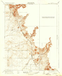
The Mariposa Co Merced Co Boundary Line defines the transition between the rising foothills and the lowlands in this 1915 survey. This preliminary edition highlights the early transportation network of the San Joaquin Valley outskirts, most notably the Old Ft. Miller and Stockton Road, a critical historic thoroughfare connecting regional centers. Water drainage patterns are clearly delineated by the paths of Owens Creek, Mariposa Creek, and Bear Creek, which flow westward from the higher elevations toward the valley floor. The map also identifies local transit routes such as the Merced Road and the prominent Merced Falls area. This document captures the landscape before mid-century agricultural and water management projects significantly altered the natural hydrology and local road alignments.
Find a feature on this map
10 named features on this map. Tap any name to fly to it.
Don’t see what you’re looking for? This feature index may not catch every label — zoom into the map to look around manually.
Map Details
Editions of this 1918 Owens Creek Map
2 editions found
Other maps of this area

1915 · Owens Creek
USGS Topo · 1:31,680

1918 · Planada
USGS Topo · 1:31,680

1918 · La Grand
USGS Topo · 1:31,680

1919 · Indian Gulch
USGS Topo · 1:48,000

1919 · Haystack Mountain
USGS Topo · 1:31,680

1919 · Plainsberg
USGS Topo · 1:31,680

1919 · Raynor Creek
USGS Topo · 1:31,680

1920 · Indian Gulch
USGS Topo · 1:62,500
1942 · Athlone
USGS Topo · 1:62,500
1946 · Le Grand
USGS Topo · 1:62,500