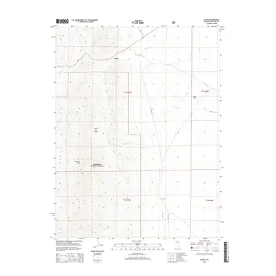
2014 Map of Illipah
USGS Topo · Published 2014About this map
Illipah marks a point of activity in this high-elevation landscape within the Humboldt National Forest, where the terrain transitions from the steep elevations of the White Pine Range and Moorman Ridge down into the wide expanse of Jakes Valley. The map details a specialized water network critical for this arid region, including Moorman Spring and Jakes Pond, alongside drainage systems like Illipah Cr and Halstead Cr. Transportation is defined by a series of graded routes such as Long Valley Rd and Jakes Wash Rd, which navigate the township and range boundaries. This survey provides an essential look at the land management and resource locations established in the early 21st century across the Nevada interior.
Find a feature on this map
16 named features on this map. Tap any name to fly to it.
Don’t see what you’re looking for? This feature index may not catch every label — zoom into the map to look around manually.
Map Details
Editions of this 2014 Illipah Map
This is the sole edition of this map. No revisions or reprints were ever made.
Other maps of this area

1949 · Treasure Hill
USGS Topo · 1:62,500

1950 · Treasure Hill
USGS Topo · 1:62,500

1951 · Illipah
USGS Topo · 1:62,500

1956 · Ely
USGS Topo · 1:250,000

1959 · Ely
USGS Topo · 1:250,000

1959 · Reipetown
USGS Topo · 1:62,500

1959 · Preston Reservoir
USGS Topo · 1:62,500

1963 · Ely
USGS Topo · 1:250,000

1979 · Mt. Hamilton
USGS Topo · 1:100,000
1990 · Antelope Mountain
USGS Topo · 1:24,000