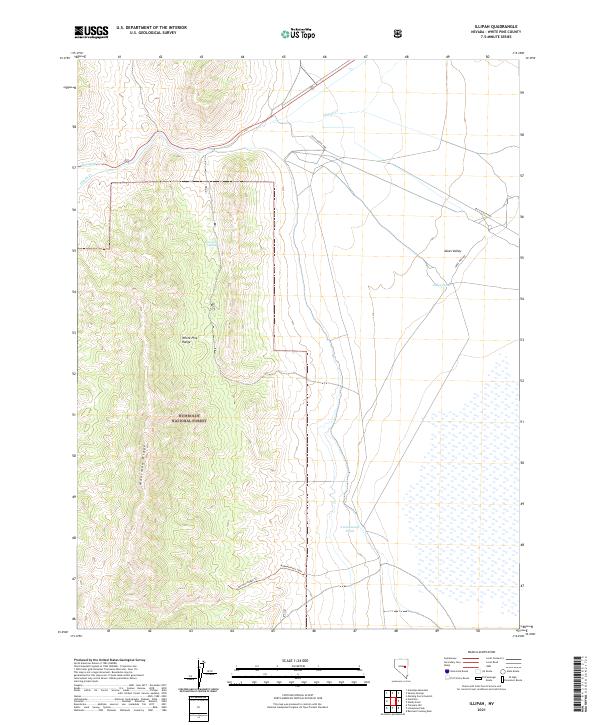
2021 Map of Illipah
USGS Topo · Published 2021About this map
The White Pine Range and Moorman Ridge dominate this high-elevation landscape within the Humboldt National Forest. The map documents a critical corridor of western transit history, featuring the Old Lincoln Hwy as it skirts the northern edge of the desert flats. This route represents one of the earliest transcontinental highways, here crossing through a region defined by seasonal water sources and rugged topography. In the lower-lying Jakes Valley to the east, the presence of Jakes Pond and Cottonwood Pond suggests the vital importance of catchment areas in an arid environment. Remote access is provided by the Morman Ridge Trail and Jakes Wash Rd, which connect the interior mountain peaks to the valley floor. Rare water features like Moorman Spring and Illipah Cr provide the only breaks in the dry terrain, marking locations traditionally essential for travel and livestock in the Great Basin.
Find a feature on this map
17 named features on this map. Tap any name to fly to it.
Don’t see what you’re looking for? This feature index may not catch every label — zoom into the map to look around manually.
Map Details
Editions of this 2021 Illipah Map
This is the sole edition of this map. No revisions or reprints were ever made.
Other maps of this area

1949 · Treasure Hill
USGS Topo · 1:62,500

1950 · Treasure Hill
USGS Topo · 1:62,500

1951 · Illipah
USGS Topo · 1:62,500

1956 · Ely
USGS Topo · 1:250,000

1959 · Ely
USGS Topo · 1:250,000

1959 · Reipetown
USGS Topo · 1:62,500

1959 · Preston Reservoir
USGS Topo · 1:62,500

1963 · Ely
USGS Topo · 1:250,000

1979 · Mt. Hamilton
USGS Topo · 1:100,000
1990 · Antelope Mountain
USGS Topo · 1:24,000