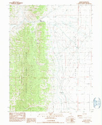
1990 Map of Illipah
USGS Topo · Published 1990About this map
Illipah (Moorman Ranch) serves as a primary human landmark in this Great Basin landscape, situated where the Butte Mountains meet the expansive floor of Jakes Valley. The map captures a high-desert environment defined by essential water management, featuring a network of ditches and diversion ditches designed to capture runoff from the White Pine Moorman Ridge. Sources such as Moorman Spring and Cottonwood Pond highlight the critical role of water for ranching and survival in the Humboldt National Forest. Land use in the late 20th century is further evidenced by a small Landing Strip, a Gravel Pit, and scattered mineral prospects, reflecting a mix of livestock management and early-stage exploration. The terrain is dominated by steep elevational shifts between the creek bottoms and the high ridges of the national forest boundary.
Find a feature on this map
18 named features on this map. Tap any name to fly to it.
Don’t see what you’re looking for? This feature index may not catch every label — zoom into the map to look around manually.
Map Details
Editions of this 1990 Illipah Map
This is the sole edition of this map. No revisions or reprints were ever made.
Other maps of this area

1949 · Treasure Hill
USGS Topo · 1:62,500

1950 · Treasure Hill
USGS Topo · 1:62,500

1951 · Illipah
USGS Topo · 1:62,500

1956 · Ely
USGS Topo · 1:250,000

1959 · Ely
USGS Topo · 1:250,000

1959 · Reipetown
USGS Topo · 1:62,500

1959 · Preston Reservoir
USGS Topo · 1:62,500

1963 · Ely
USGS Topo · 1:250,000

1979 · Mt. Hamilton
USGS Topo · 1:100,000
1990 · Antelope Mountain
USGS Topo · 1:24,000