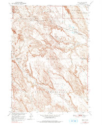
1950 Map of Imlay
USGS Topo · Published 1978About this map
Pine Ridge Indian Reservation lands dominate the southern half of this landscape, meeting the Reservation Boundary that separates Shannon Co from Pennington Co. The map documents a mid-century period where the Chicago Milwaukee St Paul and Pacific railroad served as a critical lifeline across the northern plains, passing through the small siding of Imlay. This area is defined by its transition from the structured rail corridor into the erosive breaks of the Scenic Badlands National Monument. Drainages like Big Hollow Creek, Clifford Cr, and Church Cr carve through the terrain, illustrating the complex hydrology of the South Dakota badlands before modern interstate development altered regional travel patterns.
Find a feature on this map
14 named features on this map. Tap any name to fly to it.
Don’t see what you’re looking for? This feature index may not catch every label — zoom into the map to look around manually.
Map Details
Editions of this 1950 Imlay Map
3 editions found
Other maps of this area

1950 · Sheep Mountain Table
USGS Topo · 1:24,000

1950 · Stirk Table
USGS Topo · 1:24,000

1950 · Imlay SW
USGS Topo · 1:24,000

1950 · Imlay
USGS Topo · 1:24,000

1950 · Imlay SE
USGS Topo · 1:24,000

1950 · Bouquet Table
USGS Topo · 1:24,000

1952 · Bouquet Table
USGS Topo · 1:24,000

1954 · Scenic
USGS Topo · 1:24,000

1955 · Hot Springs
USGS Topo · 1:250,000

1960 · Quinn Table SE
USGS Topo · 1:24,000