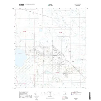
2021 Map of Immokalee
USGS Topo · Published 2021About this map
Immokalee serves as a critical agricultural and transportation hub within the interior of southwest Florida, as documented in this 2021 U.S. Geological Survey record. The settlement pattern is defined by a dense grid of residential streets such as 8th Ave and W Main St that give way to a surrounding landscape of expansive fields and drainage canals. The western edge of the community is anchored by the waters of Lake Trafford, while the eastern side is dominated by the Immokalee Regional Airport. Beyond the developed center, the topography transitions into the distinctive wetlands of Corkscrew Swamp and the Balsam Cypress Strand. For local historians and genealogists, the map identifies key community sites including the Lake Trafford Memorial Gardens Cem and the Baptist Church Cem, alongside named terrain features like Big Corkscrew Island.
Find a feature on this map
61 named features on this map. Tap any name to fly to it.
Don’t see what you’re looking for? This feature index may not catch every label — zoom into the map to look around manually.
Map Details
Editions of this 2021 Immokalee Map
This is the sole edition of this map. No revisions or reprints were ever made.
Other maps of this area

1956 · West Palm Beach
USGS Topo · 1:250,000

1957 · West Palm Beach
USGS Topo · 1:250,000

1958 · West Palm Beach
USGS Topo · 1:250,000

1958 · Corkscrew SE
USGS Topo · 1:24,000

1958 · Felda SE
USGS Topo · 1:24,000

1958 · Immokalee
USGS Topo · 1:24,000

1958 · Felda
USGS Topo · 1:24,000

1958 · Sunniland
USGS Topo · 1:24,000

1958 · Immokalee NE
USGS Topo · 1:24,000

1958 · Immokalee SW
USGS Topo · 1:24,000