
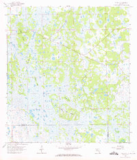
1958 Map of Felda SE
USGS Topo · Published 1959About this map
Keri Lookout Tower stands as a lonely human sentinel over a landscape dominated by the complex hydrology of the South Florida interior in the late 1950s. Located on the boundary between Hendry and Collier counties, the area is defined by a mosaic of seasonal wetlands and elevated hammocks known locally as islands. Water moves through the terrain via Lime Slough and Hooper Slough, threading between distinctive high ground such as Wild Cow Island and Butterfly Island. The 1958 topography, derived from 1951 aerial photography, captures the region before significant drainage alterations or industrial agriculture, showing only a few scattered features like a Flowing Well and narrow unimproved roads that navigate the edges of Dog Island and Grasshopper Island.
Find a feature on this map
11 named features on this map. Tap any name to fly to it.
Don’t see what you’re looking for? This feature index may not catch every label — zoom into the map to look around manually.
Map Details
Editions of this 1958 Felda SE Map
2 editions found
Other maps of this area

1956 · West Palm Beach
USGS Topo · 1:250,000

1957 · West Palm Beach
USGS Topo · 1:250,000

1958 · West Palm Beach
USGS Topo · 1:250,000

1958 · Immokalee
USGS Topo · 1:24,000

1958 · Felda
USGS Topo · 1:24,000

1958 · Immokalee NE
USGS Topo · 1:24,000

1958 · Felda NE
USGS Topo · 1:24,000

1958 · Sears
USGS Topo · 1:24,000

1970 · La Belle 4 NW
USGS Topo · 1:24,000

1971 · La Belle 4 SW
USGS Topo · 1:24,000