
1958 Map of Felda NE
USGS Topo · Published 1959About this map
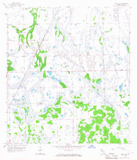
The Atlantic Coast Line railroad cuts diagonally across this 1950s interior landscape of Hendry County, representing a critical era of South Florida’s logistics and transportation development. The terrain is defined by its intermittent drainage patterns, most notably the seasonal flow of Collins Slough winding through the southeastern corner of the quadrangle. Aside from the primary rail line, evidence of earlier transit remains visible in the form of an Old Railroad Grade and various trails, including a stretch marked Private. A single Hunting Camp provides a rare point of human habitation in a landscape otherwise dominated by cypress heads and marshy basins. This survey captures a specific moment when the region’s wilderness was interlaced with industrial infrastructure and forestry access before more modern alterations to the state’s interior water management systems took hold.
Find a feature on this map
8 named features on this map. Tap any name to fly to it.
Don’t see what you’re looking for? This feature index may not catch every label — zoom into the map to look around manually.
Map Details
Editions of this 1958 Felda NE Map
3 editions found
Other maps of this area

1956 · West Palm Beach
USGS Topo · 1:250,000

1957 · West Palm Beach
USGS Topo · 1:250,000

1958 · West Palm Beach
USGS Topo · 1:250,000

1958 · Felda SE
USGS Topo · 1:24,000

1958 · Goodno
USGS Topo · 1:24,000

1958 · Felda
USGS Topo · 1:24,000

1958 · Sears
USGS Topo · 1:24,000
1958 · La Belle
USGS Topo · 1:24,000

1970 · La Belle 4 NW
USGS Topo · 1:24,000

1971 · La Belle 4 SW
USGS Topo · 1:24,000