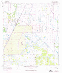
1958 Map of Felda NE
USGS Topo · Published 1974About this map
Collins Slough dominates the southeastern quadrant of this Hendry County landscape, where the natural drainage patterns of the Florida Everglades meet the emerging geometry of mid-century agricultural development. The transit infrastructure is defined by the Seaboard Coast Line running diagonally across the northwest, providing a heavy rail link for the region's produce and timber. Further east, an Old Railroad Grade and various private tracks trace earlier efforts to move materials through the wet prairies and hammocks. A solitary Hunting Camp sits near the center of the sheet, suggesting the seasonal recreational use of the land between more formal agricultural grids. The map reveals the slow transformation of the interior, as drainage canals and property lines begin to segment the sprawling marshes that once defined the southern Florida wilderness.
Find a feature on this map
6 named features on this map. Tap any name to fly to it.
Don’t see what you’re looking for? This feature index may not catch every label — zoom into the map to look around manually.
Map Details
Editions of this 1958 Felda NE Map
3 editions found
Other maps of this area

1956 · West Palm Beach
USGS Topo · 1:250,000

1957 · West Palm Beach
USGS Topo · 1:250,000

1958 · West Palm Beach
USGS Topo · 1:250,000

1958 · Felda SE
USGS Topo · 1:24,000

1958 · Goodno
USGS Topo · 1:24,000

1958 · Felda
USGS Topo · 1:24,000

1958 · Felda NE
USGS Topo · 1:24,000

1958 · Sears
USGS Topo · 1:24,000
1958 · La Belle
USGS Topo · 1:24,000

1970 · La Belle 4 NW
USGS Topo · 1:24,000