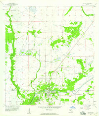
1958 Map of La Belle
USGS Topo · Published 1959About this map
La Belle sits at the southern edge of this late-1950s survey, straddling the line between Hendry and Glades counties. The settlement is defined by its relationship with the Caloosahatchee River and the adjacent Caloosahatchee Canal, which cut through the low-lying Florida landscape. North of the town center, the terrain is dominated by a complex network of wetlands and drainage patterns, most notably the meandering Pollywog Creek and its East Prong. To the northwest, the Silver Lake Ranch occupies a significant tract of land, while the eastern portion of the sheet shows the broad reach of the Okaloacoochee Slough. The map documents a period before extensive modern development, highlighting the early grid of La Belle and the primary watercourses like Bee Branch and Chaparral Slough that governed land use and transportation in the region.
Find a feature on this map
10 named features on this map. Tap any name to fly to it.
Don’t see what you’re looking for? This feature index may not catch every label — zoom into the map to look around manually.
Map Details
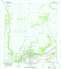
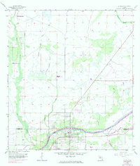
Editions of this 1958 La Belle Map
3 editions found
Other maps of this area

1956 · Telegraph Swamp NE
USGS Topo · 1:24,000

1956 · West Palm Beach
USGS Topo · 1:250,000

1957 · West Palm Beach
USGS Topo · 1:250,000

1957 · Telegraph Swamp SE
USGS Topo · 1:24,000

1958 · West Palm Beach
USGS Topo · 1:250,000

1958 · La Belle NW
USGS Topo · 1:24,000

1958 · Goodno
USGS Topo · 1:24,000

1958 · Felda NE
USGS Topo · 1:24,000

1958 · Alva
USGS Topo · 1:24,000

1958 · Sears
USGS Topo · 1:24,000