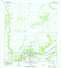
1958 Map of La Belle
USGS Topo · Published 1974About this map
La Belle sits at the southern bend of the Caloosahatchee River, serving as a vital inland hub where the borders of Glades and Hendry counties meet. The landscape north of the river is defined by a complex drainage system of sloughs and creeks, including the winding Pollywog Creek and Bee Branch. This 1958 survey, with updates from 1973, reveals a transition from natural wetlands to managed land use, evidenced by the established Silver Lake Ranch in the northwest and a central Fish Hatchery. The settlement of Muce appears along the western edge, while the south-eastern portion of the quadrangle is marked by the presence of Okaloacoochee Br. The map illustrates the early infrastructure of this Floridian river town before significant late-century development, capturing the original survey lines and waterway patterns that shaped the region.
Find a feature on this map
11 named features on this map. Tap any name to fly to it.
Don’t see what you’re looking for? This feature index may not catch every label — zoom into the map to look around manually.
Map Details
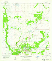
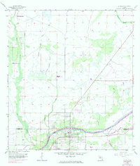
Editions of this 1958 La Belle Map
3 editions found
Other maps of this area

1956 · Telegraph Swamp NE
USGS Topo · 1:24,000

1956 · West Palm Beach
USGS Topo · 1:250,000

1957 · West Palm Beach
USGS Topo · 1:250,000

1957 · Telegraph Swamp SE
USGS Topo · 1:24,000

1958 · West Palm Beach
USGS Topo · 1:250,000

1958 · La Belle NW
USGS Topo · 1:24,000

1958 · Goodno
USGS Topo · 1:24,000

1958 · Felda NE
USGS Topo · 1:24,000

1958 · Alva
USGS Topo · 1:24,000

1958 · Sears
USGS Topo · 1:24,000